One or 2 know I use opencpn on my phone . We have a Garmin echomap 65 and have Garmin active captain on phone it's nice to have an alternate though. however
Opencpn has a few tricks it displays the old cm93 v 2 chart's which aren't updated but rocks don't move but if you get them you can display any part of the world charts
Although the file is big you can cut it down to a small area which only takes a few megabyte.
Tricks
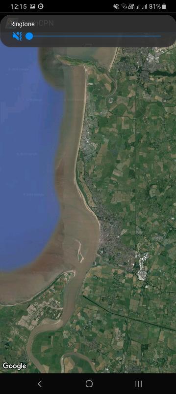
1) it will plot your position and display it on Google earth .
2) You can also take a photo of a chart any chart you own, technically you could borrow but we ll not mention that imray admiralty ordinance survey georeference it and include it into open cpn and it will overlay your position on to it .
3) it down loads grib weather files which are overlayed
4)) you can install osenc charts which are updated but paid for.
https://o-charts.org/ the UK charts are built and authorised from UK hydro office.
5) It has built in tides and currents points.
6) the laptop version which is slightly different does not have the Google maps overlay but there is a method to create charts georeference charts from google earth which can have notes added.
7) you can install on the laptop version an auto log which will record arrival times at waypoints. Etc
8 ) the laptop version can link to display ais and can be used as an autopilot if linked ( I haven't done this)
9 ) it records tracks so dingying up river with the Mobil at low water so you can record a track to follow up the channel sure that you are in the channel is possible .
10)There is an internet link plug-in that links to user supplied area info a sort of pilot book however not many people use that in the UK and so info is sparse.
All for free. But for osenc There are 2 version in Google play a free one which will do all the above but only uses internal memory of the phone .
Or a paid version which will use sdcards (it's about 5 or 6 £) .
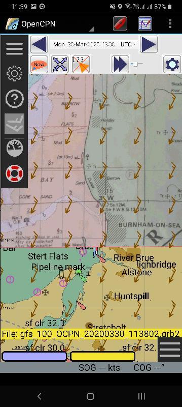
I will post a few screen shots this one shows the current wind overlay30 march and a part of a 25 year-old chart of Burnham in the Bristol channel
I just installed it to show how it works you can do a full chart but it's better to do it in sections as then the georeference can be really accurate.
You can quilt the charts . It is very straightforward.
There are advantages, the charts that you convert you can update, put notes on or information you want to use
Note the grib wind overlay.
The Google map chart tab
This has the overlay of the 25 year old chart I georeferenced for an example . The blue and yellow bar towards the bottom switches between chart blocks the blue is the raster charts and the yellow is cm93. I think red would be bought charts paid yearly around 20 to 40 a year updated depending on area.
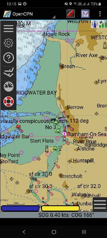
As I'm not on the boat it cannot plot the position .
The boat plot can be changed to suit your eyes .
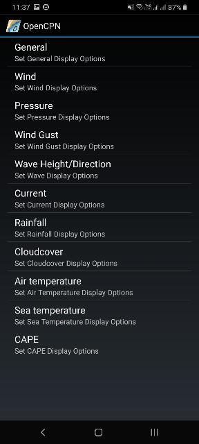
The grib download options.
Tides
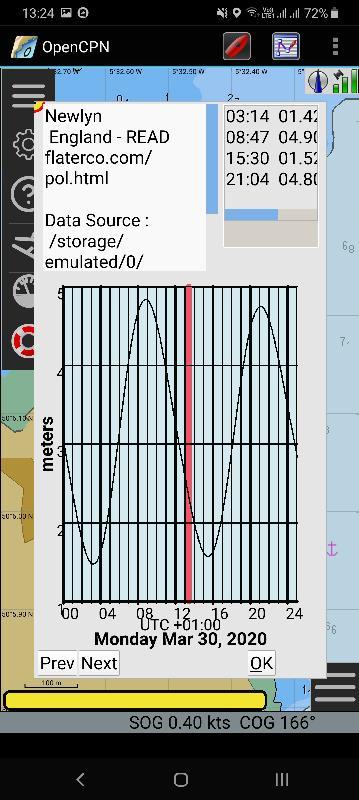
The small blue and white state of tide height indicator.
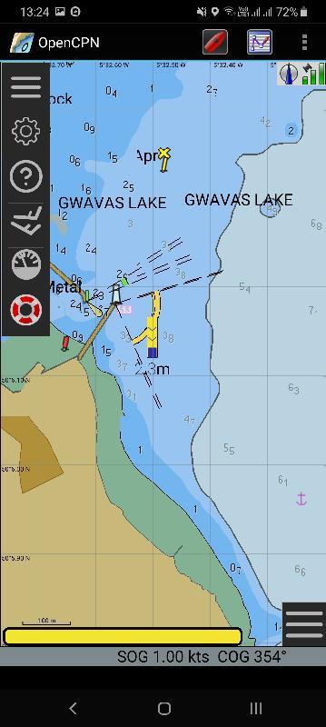


Comments
Request the grib download and it overlays the file is saved so switching it's display on or off is just a tap on the menu arrows the grib download has a select for 1/2 /5 or more days with frames set at whatever 1 to 12 hours intervals and it just over lays over the area you want . The display options are amazing . From wind to waves to isotachs . It all done on move no messing.Its integrated into the app . I must admit I haven't played with the options that much . I have it on the tablet for bigger display but it make my arms ache lazying about.
Press the go button and it displays like a video or the weather forecast on the TV.
Oh just realized that the grib weather files plugin is only
On the paid for app . I paid 6£ one off payment a couple of years ago. it might have gone up a couple of quid now..
It looks good but my ship , intact a couple of ships will have to come in for me to afford that at the min . We are the church mices fleas at the minute!
Routes and waypoints and tracks . It is easy to create waypoints, and routes and tracks more than that they can be saved with standard compatability with chart plotters
Garmin , navman . Tracks and routes and waypoints can all be transferred to a Garmin I have uploaded to both to a 450s and a 650s Garmin they also lcan be loaded and used in the newer echomap Garmins they can also receive a track or route or waypoint list from Garmins or other standard Plotters.
That's the menu
That's a simple measure between 2 points.
It has a lot of controls particularly one you can set it to take .PNG pictures rather than .jpg . The .PNG format is very good for txt , an iPhone uses .PNG for screen shots .
You can scan a chart many scanners have an .PNG option if you have an iPhone it's best to take the picture of the chart then screenshot it and use the screenshot to make the chart. It is possible to convert s .jpg to a .PNG with a convert app..
Anyways, here is my photo of a chart of St Malo out of bloc marine .
By the way sorry the photo a small it might make the txt quite blurry
I was careful to line up the long and lat with the edges , it's easy to aline with a photo editor but mapcal2 does take account of slightly skewed charts and so does opencpn . You have to be careful to try to make the picture flat and the grids parallel, but it will still callibrate and produce an accurate position even allowing for lens distortion. The program is part of the seaclear navigation package that is freely available for Windows it is 10 /20 years old and will run on xp vista windows 7 .. it should run on win 8 and 10 but might have to run with s compatibility mode , it's available for free download here . Its best to down load and use the most recent version
http://www.sping.com/seaclear/
The download is a library and you have to extract the programme. Mapcal2 out of the zip folder into a folder and put the chart photo PNG file in with it
I took the picture allowing a good border around the edges to minimise distortion which I then used a photo editor (gimp free download and it is very good) to crop the edges off . It can be used to improve contrast and brightness.
Run mapcal2.exe and then open the .PNG. In my case it was stmalo.png you will be faced with this
Well nearly this .. I run Linux so have virtualbox and run vista in it basically the box window has a running version of Windows in and as mapcal2 only runs in window I run it in that . I can have vista ,XP, win7 even raspian pie all at the same time!
The box shown is the border box you can mark the corners of the area of the chart that you want to use as a raster image . The quilting option in opencpn let's you move from one chart to another seamlessly you can of course switch by choice. Between vector raster and bought charts even producing your own little charts of unsurveyed channels or bays. The north Cornwall coast has miles of unsurveyed bays .
It's just a case then off filling boxes in with latitude an longitude for selected points only 2 points are needed but you can use as many as you need and in particular if the photo has any photo grid distortion you can select points to straighten the distortion. Top left corner has a little drop in the latitude line . I will post a picture of how the calibration allows for this and produces accurate GPS grid.
The lock lat long allows you to freeze lat long points
It is actually very easy and simple to use in practice.
once you have put all the calibration points in you can use as many as you need to take out photo distortion.
Then you activate the grid . If all the chart info is input Yoo can save the calibration.
Which creates a file in the same folder call CHARTCAL.DIR .
Activated grid saved
I will go through the process and then say where to get the little programmes .
Using the windows command prompt you run first mc2bsbh. Makechart2bsbheader this changes the DIR text file into a header for the chart. Then you run imgkap.
Which adds the photo image PNG file to the calibration header file and produces the chart. ( stmalo.kap) which you transfer to the chart folders of opencpn..
Screenshot of process.
This is a screenshot of the chart loaded into opencpn showing SVG charts with the border of the stmalo raster chart
Switch to raster display and the created photo chart is now in place note the latitude and longitude line up exactly and then 2 screens of close up of SVG and just created raster photo showing bouys position lining up.
The 3 programs link together to the folder .
And say you divide a large chart into 12 and photo each section with slightly overlapped borders all saved into one folder mapcap2 Will append each of the 12 calibrations into one CHARTCAL.DIR. then 1 run of mc2bsbh will produce 12 chart headers and imgkap will produce all 12 quilted charts which will act seamlessly as you sail a route across.
And android
Windows available here . There is also a comprehensive manual. And 40 plugins.
https://opencpn.org/OpenCPN/info/downloads.html